

Arches National Park GPS Chart app for iPhone and iPad
Developer: Flytomap
First release : 03 Feb 2009
App size: 31.48 Mb
Flytomap - "Solutions for better voyages"
About the Park:
Arches National Park were named by President Herbert Hoover. In 1929, he signed the legislation creating Arches National Monument, to protect the arches, spires, balanced rocks, and other sandstone formations. Arches National Park lies north of Moab in the state of Utah. Bordered by the Colorado River in the southeast, it’s known as the site of more than 2,000 natural sandstone arches, such as the massive, red-hued Delicate Arch in the east. Long, thin Landscape Arch stands in Devils Garden to the north. Other geological formations include Balanced Rock, towering over the desert landscape in the middle of the park.
About Map features:
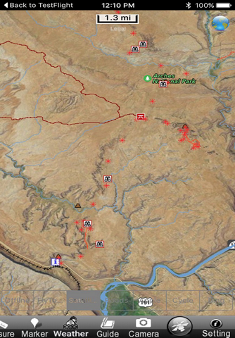
Offline Park Map
Satellite Map Overlay
Topo Map Overlay
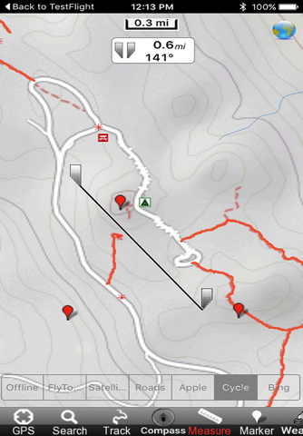
GPS to locate positions
Compass
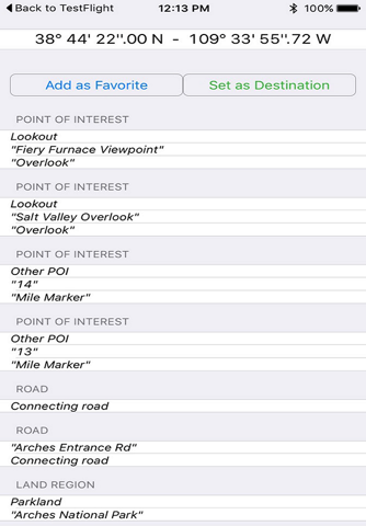
Add unlimited Favorites
Record & email Tracks
Email favorites & Photos
Search places by name & Lat/Lon
Turn ON/OFF names and Elevation contours to avoid clutter
“Insert the target/destination ‘Waypoint’ and see in real time your speed, distance and direction to destination”
“Zoom, Rotate and Pan fast just by a finger touch”
“Geo-Tagged photo management”
................................& more
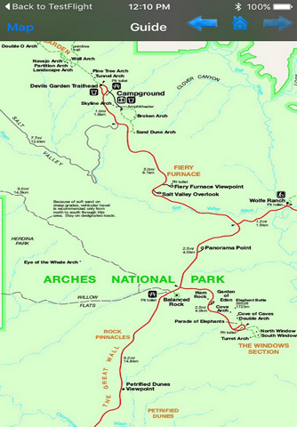
"Park Map contains Guide for quick reference with necessary links"
"Enjoy great voyages"
NOTE:
• Continued use of GPS running in the background can dramatically decrease battery life.
• Turn off GPS when not in use